A powerful derecho storm moved through the Upper Midwest on the Friday night of July 19, gathering up 73 damaging wind reports, according to the National Weather Service, and the same area remained under threat of more severe weather Saturday, July 20 for northern Iowa, southern Minnesota, Wisconsin and Michigan. Its believed that this storm dissipated before it reached the eastern Great Lakes Region including southern Ontario in Canada and the northeastern United States around the 21st of July. Friday’s event resulted in only the sixth known watch (Tornado or Severe Thunderstorm) with Wind Gust potential of up to 105 MPH.
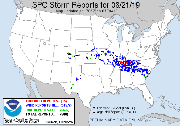
With ample instability and unusually strong wind shear for late June in place, these storms produced widespread damaging winds in every Middle Tennessee County. Thousands of trees were blown down across the region, including some that had been standing since the Civil War. Damage to power lines and poles resulted in an estimated 100,000+ power outages, with some people without electricity for up to 1 week. In addition to the damaging winds, large hail up to quarter size was reported, and several mesocyclones within the line of storms spawned 4 tornadoes and several funnel clouds.
(Source: Wikipedia and National Weather Service)
